By James Hanlon
Leader Staff Writer
The M-24 northbound detour officially begins today, June 3. From now until mid-November, M-24 will be closed to northbound traffic from Drahner Rd. to Harriet St. Southbound M-24 traffic will continue to be one-lane-only.
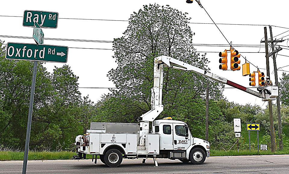
The detour will take traffic east on Drahner Rd. to northbound Oxford Lake Drive, then north on Glaspie Street/Oxford Road, then finally west on Ray Rd. back to M-24.
The northbound detour is limited to one lane as the other lane along that route will remain open to southbound traffic.
Before the COVID-19 shutdowns, it was estimated that 30,000 vehicles a day would travel through the northbound detour route.
With increased traffic along the route, temporary traffic signals have been installed at the three-way intersections of Ray and N. Oxford, and N. Glaspie and East streets.
Recently, the signals at Ray and N. Oxford have been flashing red on all three sides of the intersection. Now that the main detour route is in effect, the signal will switch to a standard green-yellow-red cycle.
The signal at N. Glaspie and East can be remotely activated by the Oxford Fire Department, when needed, to allow fire vehicles using East St. to make left and right turns onto N. Glaspie St. When not in use by the fire department, the temporary signal will flash yellow for traffic on N. Glaspie St. and flash red for traffic on East St.
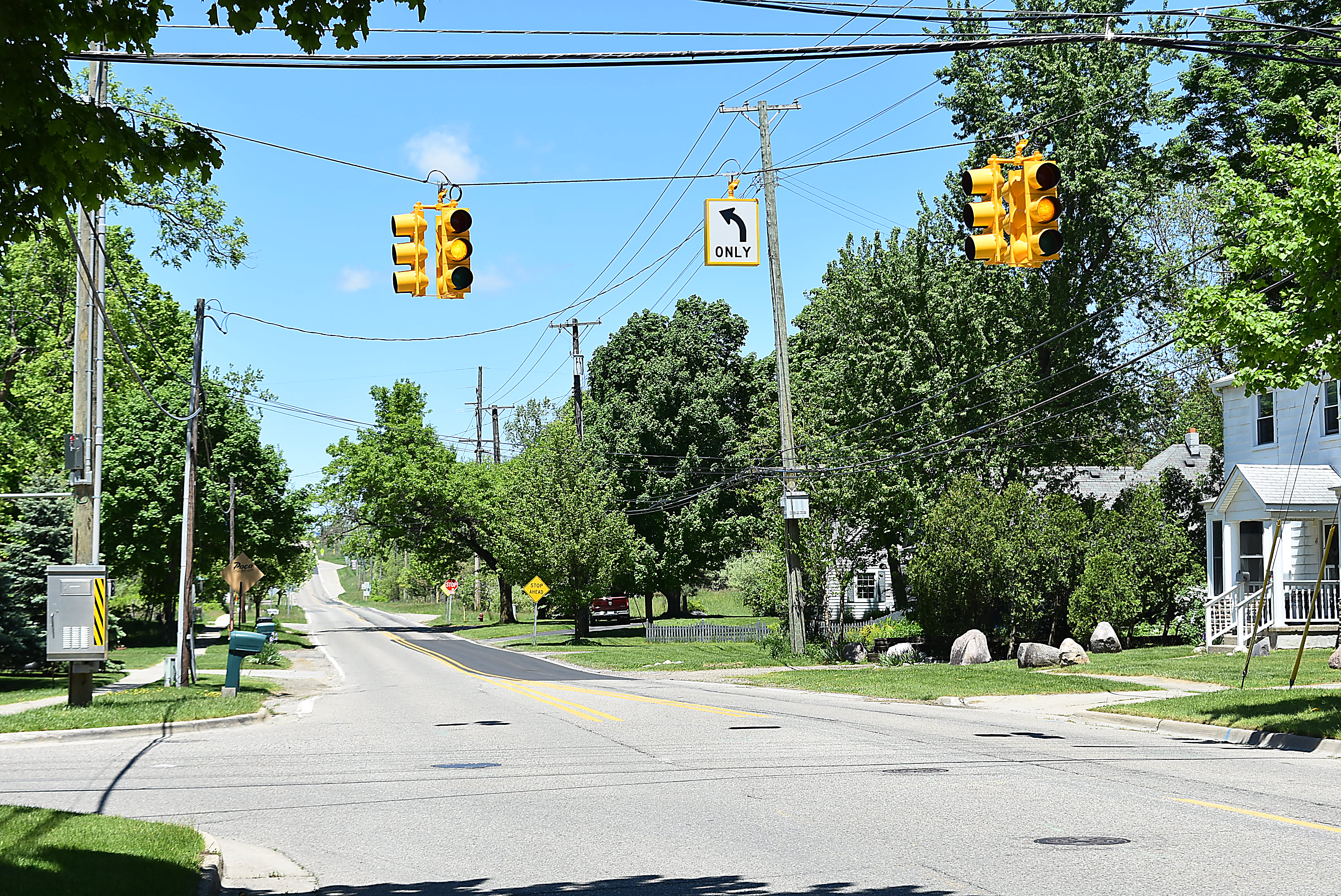
Temporary left turn arrows have also been installed at the Glaspie St. and Burdick St. intersection for north and southbound traffic turning onto Burdick.
At a May 18 virtual town hall meeting, Oxford Village Manager Joe Madore indicated he would try to keep the turn arrows there even after the project ends. “It wasn’t a huge reconfiguring of the whole intersection, so we’ll have to look at that as an option going forward,” Madore said.
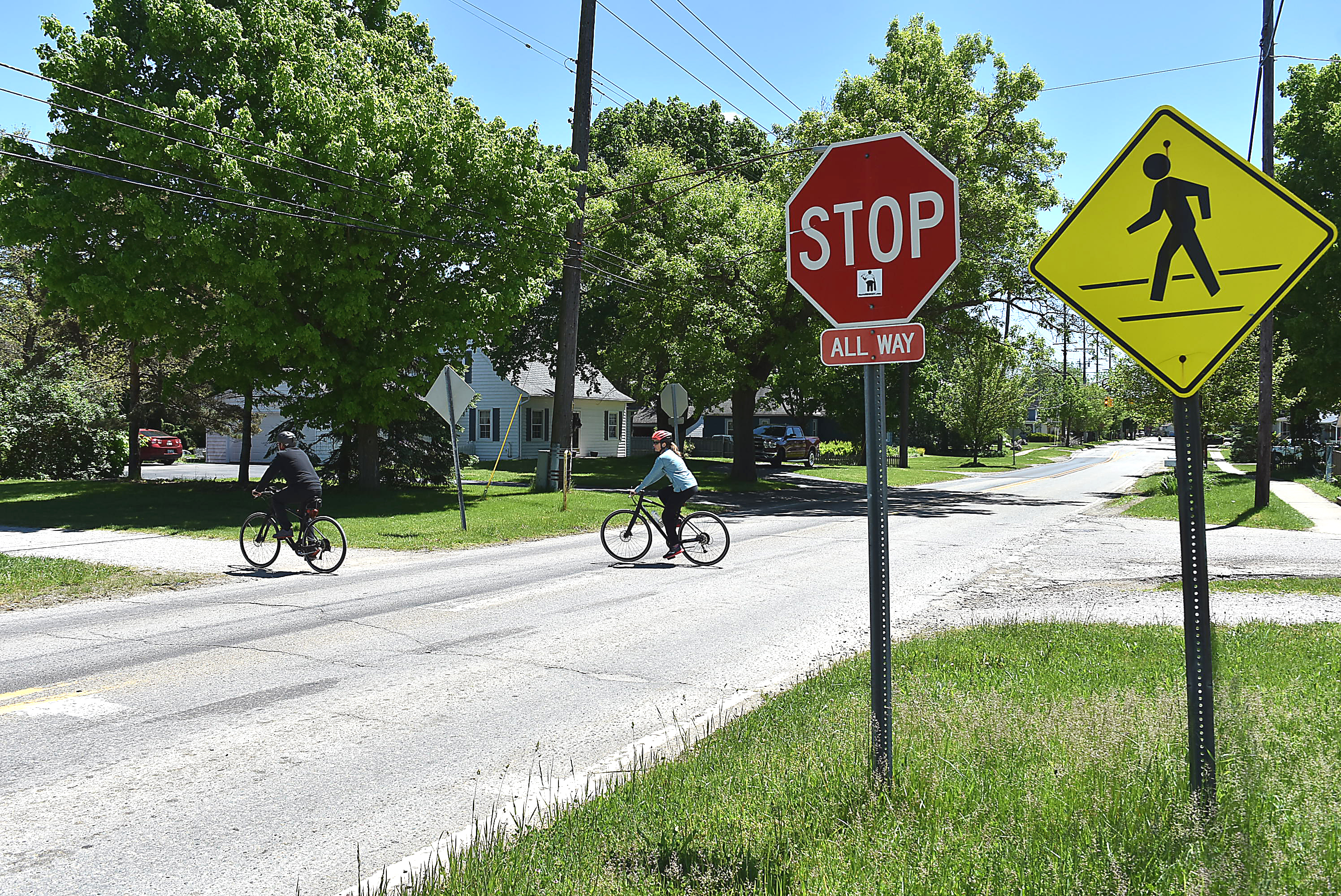
It’s not only new traffic signals. The two stop signs for north and southbound motorists at the Polly Ann Trail/N. Glaspie St. intersection will be temporarily removed for the remainder of the project, to help keep traffic flowing.
The stop signs for trail users heading east and west are still in place. Trail users are advised to exercise caution when traveling through this intersection since vehicles on Glaspie St. will no longer be required to stop there.
Additional temporary bollard stop signs will be placed in the middle of the trail, on both the east and west side of the intersection, with signs warning “cross traffic does not stop.”
Motorists are still encouraged to watch out for trail users at the intersection.
The M-24 construction project has entered Stage 2. Work at the Drahner Rd. intersection has switched to the west side and will continue there until early July. Until then, traffic will be unable to flow through the west intersection.
Southbound M-24 to westbound Drahner Rd. will be detoured to westbound Burdick Rd., then southbound Pontiac St. back to W. Drahner Rd.
Westbound Drahner Rd. will be detoured via northbound Oxford Lake Dr. to northbound Glaspie St., then westbound Burdick St. to southbound Pontiac St., back to W. Drahner Rd.
Eastbound Drahner Rd. is just the opposite. Eastbound traffic will be detoured via northbound Pontiac St. to eastbound Burdick St., then southbound Glaspie St. to southbound Oxford Lake Dr., back to Drahner Road.
Updates and detailed project information can be found at Restorem24.info (MDOT’s website) and Restorem-24.com (Village’s website).
Traffic signals go up, stop signs come down along M-24 added by James Hanlon on
View all posts by James Hanlon →
As a frequent user of the trail and avid cyclist, i was surprised to see this sign yesterday. It is dangerous for all trail users having to now cross the equivalent of Lapeer Road with (less traffic for the moment), that is why the bridge was built.
This will prevent families with small kids from crossing the trail in that intersection and will be very dangerous for kids and teenagers on their own as well as adults. I would of expect that actually due to the increased traffic in Glaspie. More signaling for cars to slow and stop at the trail intersection be added.
Lapeer is not closed after all for traffic!