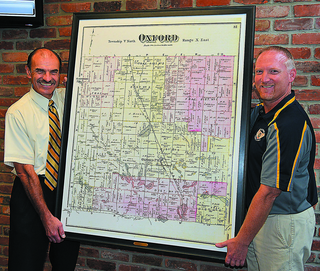
An interesting piece of local history will soon be adorning the meeting room where the Oxford Board of Education conducts its business.
It’s a gift from one unit of government to another.
Last week, Oxford Township gave the school district a framed copy of an 1872 map of the community. It shows the township divided into nine small school districts.
“We’re delighted,” said Superintendent Tim Throne. “Obviously, history is important to us.”
According to township Clerk Curtis Wright, the original map came from resident Fred Latta. The township decided to have two 36-inch-by-46-inch copies made, one to hang in the township meeting room and one for the district.
“On behalf of the district, I want to thank Curtis and the township for finding this and giving us a copy,” Throne said.
Wright did a little detective work and determined via the Oakland County archives that the map is from 1872.
The large number of school districts in 19th-century Oxford is not unusual, according to November 1990 report prepared by the Citizens Research Council (CRC) of Michigan.
In 1870, there were 5,108 school districts in Michigan serving a total of 278,686 students.
The number of districts grew to 6,352 in 1880 and reached 7,163 by 1900, which represents a 131 percent increase from 1850. However, 1,004 of those districts in 1900 contained less than 15 students, the CRC report stated.
Today, there are 540 local school districts, like Oxford, spread across the state. When intermediate school districts, public school academies and educational achievement authorities are added in, the number climbs to 899 districts, serving 1.5 million students.
But why were there so many districts in the 1800s?
According to the CRC report, there were two big factors.
One, Public Act 50 of 1843 stated no school district within a township could be larger than nine sections, which usually equalled nine square miles.
That’s small compared to some modern districts.
To put that in perspective, the Oxford school district today is 96 square miles and includes portions of six townships and two villages spanning Oakland and Lapeer counties.
Secondly, the state superintendent in 1877 observed, “There is, in Michigan, a feeling prevailing to a greater degree than in most other states that abhors centralization and resents outside interference.”
In other words, folks were leery of government power beyond their town borders and preferred to preserve local control.
The 1872 map of Oxford also shows some “fractional” school districts, which contained land from two or more townships. They were created to accommodate homogeneous communities that crossed township lines, according to the CRC report.

Leave a Reply